
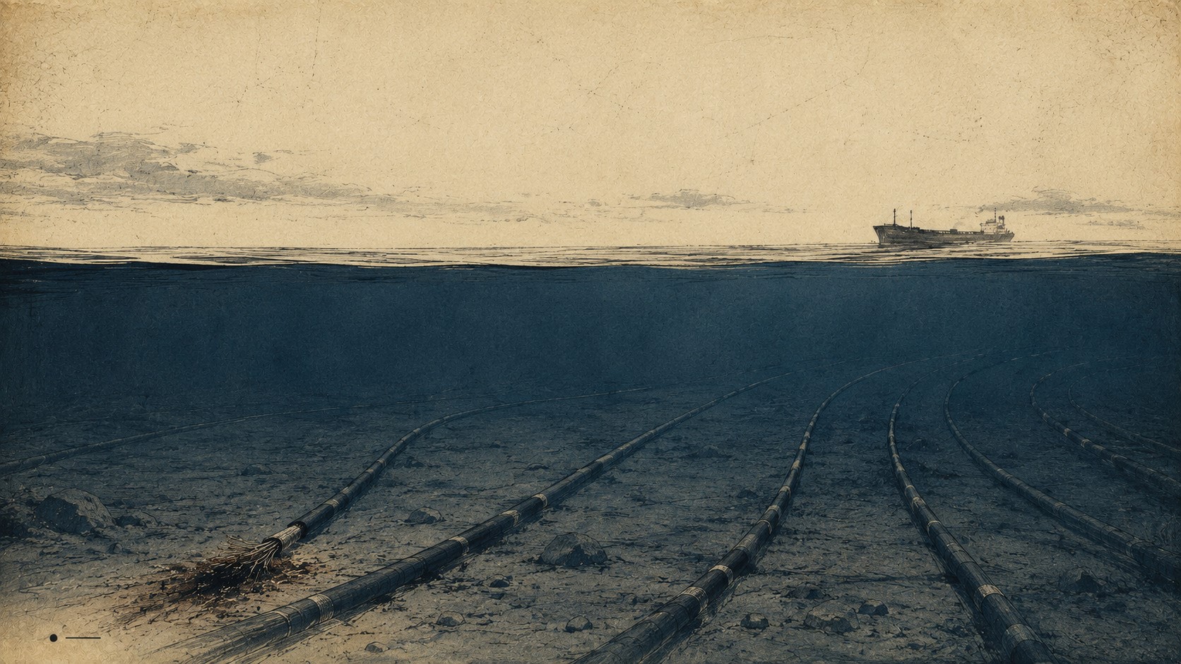

Most submarine cables break without anyone attacking them.
Fishing gear catches them. Anchors damage them. Seismic activity and underwater landslides occasionally do the rest. Globally, submarine cable systems suffer roughly 150 to 200 faults in a typical year, and most attract little attention beyond the engineers responsible for fixing them. Traffic moves onto alternative routes, maintenance teams locate the fault, a cable ship sails and, eventually, the damaged section returns to service. What looks from shore like an extraordinarily fragile web of glass laid across the ocean floor has proved, in ordinary conditions, remarkably resilient.
That distinction matters. Much of the recent debate over seabed warfare begins with photographs of damaged cables and proceeds directly to vulnerability. Yet a broken cable, by itself, demonstrates very little. The global network was built with failures in mind. Route diversity, spare capacity and traffic rerouting allow operators to absorb individual outages, while a specialised maintenance industry has spent decades repairing the physical damage. The interesting question is therefore not whether an anchor can sever a cable. It plainly can. The question is what happens when failures cease to occur according to the untidy probabilities of commercial life and someone begins choosing where, when and how many occur.
That is where an engineering problem becomes a strategic one.

The Baltic test: where damage ends and attribution begins
The Baltic has already provided something more useful than a neat sabotage narrative: a series of incidents that look remarkably similar from the surface and become remarkably different once investigators reach the seabed. A pipeline ruptures. A cable goes dark. An anchor track appears. A vessel is identified. From there, however, the evidentiary stories diverge.
The sequence began in October 2023 with Balticconnector. Finland’s National Bureau of Investigation initially reconstructed a dragging trace leading towards the damaged pipeline and focused its investigation on the Hong Kong-flagged Newnew Polar Bear. By May 2025, the NBI had gone further, stating that the vessel’s anchor caused the damage. Yet the criminal investigation remained open, with Finnish authorities continuing cooperation with China and Hong Kong. What public evidence had established was causation. It had not established why the anchor came to be dragged across the pipeline, still less that a state had ordered it.
A year later, the problem became harder. On 17 and 18 November 2024, the BCS East-West Interlink between Sweden and Lithuania and C-Lion1 between Finland and Germany were damaged as the Chinese bulk carrier Yi Peng 3 passed through the Baltic. Because China retained jurisdiction over the vessel, a criminal investigation could not take place onboard under Swedish authority. European investigators participated only as observers. Interviews with crew members could not be recorded, while the examination took place more than a month after the cable breaks, reducing access to electronic material. The law of the sea had entered the evidence chain.
The physical evidence nevertheless remained striking. Swedish investigators found that Yi Peng 3 had dragged its port anchor for roughly 180 nautical miles over about a day and a half. Yet unusual conduct is not the same thing as proven intent. Swedish Prime Minister Ulf Kristersson captured the problem unusually well in January 2025. Sweden, he said, would not accuse anyone of sabotage without very strong grounds. Nor, given the security environment and repeated Baltic incidents, could hostile intent simply be excluded. Between those two positions lies most of the difficulty.
When the anchor is known but the intent is not
Then came Eagle S. On Christmas Day 2024, its anchor fell into the sea and the vessel dragged it along the Gulf of Finland seabed, cutting Estlink 2 and several telecommunications cables. Finnish prosecutors subsequently brought charges against the master, chief mate and second mate. Yet the court proceedings contained a crucial distinction that much of the earlier political discussion had blurred: the prosecution did not allege intentional cable damage. It alleged that the officers knew about the poor condition of the anchor windlass and had intentionally neglected their duties.
Even that did not settle the matter. The Helsinki District Court found that the loss of the anchor resulted from failure of its securing mechanism. Because the alleged negligence related to duties onboard, the court classified the case as an “incident of navigation” within the meaning of the United Nations Convention on the Law of the Sea. It concluded that criminal-law competence belonged to the courts of the ship’s flag state or the defendants’ states of nationality. The judgment was not final. The case therefore illustrates a problem deeper than simple attribution. Investigators may establish the damaged infrastructure, the physical mechanism and the vessel involved, yet still encounter separate barriers over intent, criminal responsibility and jurisdiction.
The cases that refuse the easy narrative
The Vezhen case provides the necessary counterweight. When a Latvia–Sweden communications cable was damaged on 26 January 2025, Swedish authorities opened an investigation into gross sabotage and seized the vessel suspected of involvement. Suspicion was reasonable enough to investigate. It was not evidence enough to preserve the accusation.
Just over a week later, the Swedish Prosecution Authority announced that the investigation had clarified that the incident was not gross sabotage. Investigators concluded that a combination of weather conditions, equipment deficiencies and shortcomings in seamanship had contributed to the cable break, and the seizure of the vessel was lifted.
That case matters precisely because it refuses to cooperate with an easy narrative. The same outward event, a communications cable suddenly failing while a merchant vessel passes nearby, can result from an accident. Effective investigation must therefore be capable not merely of escalating suspicion but of reducing it.
The Baltic produced another test on the final day of 2025. Two Finland–Estonia telecommunications cables were damaged, and Finnish authorities took control of the Fitburg during a joint operation intended to prevent further damage. By 5 June 2026, the National Bureau of Investigation had completed its criminal investigation. The case concerned suspected aggravated criminal damage, attempted aggravated criminal damage and aggravated interference with telecommunications, and concluded with four suspects. The matter then moved forward from investigation towards prosecutorial consideration.
Taken together, these cases resist the conclusion most convenient to either side of the argument. They do not demonstrate that concern over Baltic infrastructure is imaginary. Repeated anchor dragging across critical infrastructure, sometimes over extraordinary distances, plainly deserves security attention. Neither do they establish, on the public evidence available, a single state-directed sabotage campaign.
What they reveal instead is an evidentiary ladder. Damage can be established without mechanism. Mechanism can be established without intent. Intent, if established, would still not identify who directed it. And even strong physical evidence may collide with jurisdiction before investigators reach the final questions.
That distinction will matter increasingly in seabed warfare. A cable break can be repaired. Attribution requires something less mechanical: evidence capable of surviving the distance between suspicion, prosecution and state responsibility.
The Baltic has already shown how long that distance can be.
The attribution trap: when evidence is not enough
The Baltic cases leave Europe with an uncomfortable abundance of evidence. Investigators can recover anchors, reconstruct tracks, inspect damaged cables, question crews and identify the vessel that passed over a particular point of seabed at a particular hour. Modern maritime surveillance can make the physical history of an incident surprisingly difficult to erase.
The political history is harder.
That distinction sits near the centre of seabed warfare. Physical attribution asks what damaged the infrastructure. Criminal investigation asks whether somebody committed an offence. Strategic attribution asks whether the act belonged to something larger and, eventually, whether responsibility reaches a state. The same broken cable can therefore generate several different answers, each arriving under a different evidentiary standard.
International maritime law adds another complication. Article 97 of UNCLOS places important limits on penal or disciplinary proceedings arising from collisions or other incidents of navigation on the high seas, while Article 94 assigns extensive jurisdictional and investigative responsibilities to flag states.
Neither provision was written as a manual for hybrid conflict. Their logic belongs to an international maritime order in which ships move between jurisdictions and rules are needed to determine who investigates whom. Critical infrastructure complicates that geometry. A vessel may sail under one flag, employ officers of several nationalities, be owned through companies registered elsewhere and damage infrastructure serving states that exercise neither flag-state jurisdiction nor authority over its crew.
The result can be peculiar: the state suffering the strategic consequence need not be the state holding the strongest legal authority over the people who caused it.
That is not a loophole invented by an adversary. It is a feature of the maritime legal order. Yet once intent itself becomes disputed, that feature acquires strategic significance.

A ship is not a state
Suppose investigators overcome those difficulties. Suppose they establish the vessel, the mechanism and the conduct. Suppose they go further and prove that the damage was deliberate.
They have still not necessarily attributed the act to a government.
International law is considerably more demanding about that transition than political rhetoric sometimes suggests. Under the International Law Commission’s Articles on Responsibility of States for Internationally Wrongful Acts, conduct by private persons does not ordinarily become state conduct simply because those persons have some connection to a country. Article 8 requires a much more substantial bridge: instructions, direction or control by the state over the conduct concerned.
Flag is not instruction. Ownership is not control. Nationality is not direction. A vessel’s commercial relationships or trading history may justify scrutiny, perhaps intense scrutiny. They do not complete the chain from ship to state.
The evidentiary ladder therefore extends further than the Baltic cases initially suggested:
damage → mechanism → vessel → conduct → intent → external direction → state attribution
Every step eliminates explanations. None automatically supplies the next.
This is also where discussion of the grey zone becomes dangerously easy. Ambiguity can result from deliberate concealment. It can also result from bad weather, defective machinery, unavailable electronic records, competing jurisdictions, imperfect surveillance or an investigation that simply has not reached an answer.
Uncertainty is not evidence of a strategy of uncertainty.
Otherwise the argument becomes circular. If every failure to attribute an incident were itself treated as evidence that somebody deliberately engineered plausible deniability, plausible deniability would become impossible to disprove.
Europe’s problem is subtler. An adversary does not need ambiguity to prove that an operation succeeded. Ambiguity becomes useful only if it increases the defender’s cost of deciding what to do next.
The European Union has now begun planning explicitly around that possibility. Its February 2025 Action Plan on Cable Security warns that insufficient cooperation at regional, national and European level can be exploited in a hybrid campaign, using fragmented surveillance mechanisms to evade detection and create plausible deniability.
That wording matters. The EU is not proving that every ambiguous cable incident constitutes a hostile operation. It is planning on the assumption that a capable hostile actor could exploit the attribution gap deliberately.
That is a very different claim.
Deterrence before certainty
The distinction changes how deterrence must work.
Deterrence by punishment functions most cleanly when the message is straightforward: if you do X, we will know you did X, and we will impose Y. Attribution occupies the middle of that sentence. Weaken confidence there and punishment becomes harder to calibrate.
A government may strongly suspect responsibility while possessing intelligence it cannot disclose. Investigators may know the vessel but not the intent. Prosecutors may establish individual criminal conduct without reaching external direction. Allies may privately share an assessment while remaining below the threshold required for public state attribution.
NATO’s response in the Baltic suggests another approach: make uncertainty less operationally useful before the attribution problem has been completely solved.
When the Alliance launched Baltic Sentry in January 2025, it committed frigates and maritime patrol aircraft, announced a small fleet of naval drones and moved to integrate national surveillance assets with NATO systems to improve threat detection.
Mark Rutte then added the enforcement dimension. Potential threats to infrastructure, he said, could face consequences including “boarding, impounding, and arrest.” Crucially, he immediately distinguished those national law-enforcement powers from NATO’s role in detecting threats and deterring aggression. NATO detection and deterrence, in other words, could operate alongside national enforcement without pretending that the two were legally interchangeable.
The strategic logic is important. A government does not need to know which state, if any, sits behind a suspicious vessel before watching it more closely. Investigators do not need state attribution to preserve evidence. National authorities do not necessarily need to solve the geopolitical case before taking lawful action against dangerous conduct. And operators certainly do not need to know who caused a cable break before beginning to repair it.
This is where the attribution problem becomes a problem of time.
Four clocks begin running from the same broken cable.
A hostile operator would act in operational time. Planning precedes the incident; execution may take hours. By the time the other three clocks begin their work, the operation itself is already over.
The operator moves in engineering time. Traffic must be rerouted, the fault located, spare cable prepared and a vessel dispatched. Waiting for geopolitical certainty is not an option.
Investigators move in evidentiary time. Tracks must be reconstructed, equipment examined, crews interviewed, electronic records obtained and competing explanations eliminated. That may take weeks, months or longer.
Governments move in political time. They must decide how much confidence is sufficient for accusation, sanctions, interdiction or collective action, often before investigators have completed their work.
Attack and attribution move at different speeds.
That makes resilience strategically more interesting than the word usually suggests. Faster detection, alternative routing, spare capacity and rapid repair do more than keep data moving. They shorten the interval during which physical disruption can generate strategic or political pressure while responsibility remains unresolved.
In that sense, resilience compresses the value of ambiguity.
NATO’s surveillance performs a related function at the other end of the timeline. Better monitoring can shorten the interval between suspicious conduct and intervention. Rapid interception can preserve evidence that might otherwise disappear. Integrated surveillance can make movements intelligible across national jurisdictions before investigators are left reconstructing them months later.
One approach reduces the consequences after the cable breaks.
The other reduces the freedom to act before it breaks.
Neither requires Europe to pretend that uncertainty has disappeared.
And that caveat remains essential. The existence of an attribution problem does not demonstrate that an adversary has successfully exploited it. EU concern about plausible deniability is an institutional threat assessment, not retrospective proof of a state-directed Baltic sabotage campaign. NATO’s surveillance measures tell us what the Alliance wants to prevent, not who caused every incident that preceded them.
The Baltic evidence has already shown why those distinctions matter.
But it also leaves a harder strategic question.
Dragging an anchor across a cable requires relatively little understanding of the network beneath it. Selecting failures for maximum effect would require considerably more.
An adversary would need to know which cables matter, which routes merely appear redundant, where separate systems converge, where landing stations concentrate connectivity and which combinations of disruption would place the greatest pressure on repair capacity.
In other words, it would need to understand the network behind the map.
That requires something beyond the ability to damage infrastructure.
It requires knowledge.
And knowledge of the seabed has been a military mission for a very long time.
The map beneath the map: what matters is not where the cables are
Cutting a submarine cable is comparatively simple. Understanding which cable is worth cutting is not.
That distinction changes the nature of seabed warfare. The approximate geography of the global cable network is hardly secret. Commercial maps show routes and landing points, operators publish network information, and governments possess considerably more detailed hydrographic and infrastructure data. Knowing that a cable crosses a particular stretch of seabed is therefore only the beginning.
Strategically useful knowledge lies deeper. Which apparently separate systems share the same physical corridor? Where does route diversity narrow? Which landing points concentrate connectivity? Which cables carry unusual volumes or connect particularly important nodes? How quickly can capacity migrate elsewhere? Where are damaged systems hardest to reach, and how rapidly can repair assets arrive?
Location is not topology.
An adversary seeking indiscriminate disruption needs comparatively little of that knowledge. An adversary seeking to select failures for maximum effect would need considerably more. It would need to understand not simply the lines drawn across the seabed, but the relationships between them.
That is the map beneath the map.

Reconnaissance without destruction
Russia possesses specialised capabilities for operating in precisely this environment. At their centre sits the Main Directorate for Deep-Sea Research, better known by its Russian acronym, GUGI.
The organisation should be described carefully because capability, reconnaissance and hostile action are not interchangeable. GUGI operates specialised submarines, deep-diving platforms and support vessels designed for work far below the operating depths of conventional naval forces. RUSI’s analysis of Russian seabed capabilities describes an architecture extending across seabed mapping, underwater surveillance, telecommunications interception and potential operations against undersea infrastructure.
Some of those capabilities are extraordinary. RUSI has documented specialised submarines including the Paltus, X-Ray and Losharik, assessing the latter as capable of operating at depths of roughly 2,500 metres. Longer deployments can involve converted submarine motherships, while surface vessels such as Yantar can support deep-diving submersibles and underwater systems.
That describes capability. It does not prove conduct against any particular cable.
The public record becomes firmer when the analysis moves from what Russian systems can theoretically do to what Western governments say they have actually observed.
In January 2025, Britain’s Defence Secretary told Parliament that the Russian vessel Yantar was engaged in gathering intelligence and mapping Britain’s critical underwater infrastructure. The Royal Navy had tracked the vessel through British waters, while London disclosed that a British submarine had surfaced near Yantar during an earlier deployment after monitoring its movements close to critical infrastructure.
The episode mattered because nothing needed to break.
Reconnaissance can have strategic value without producing an outage, a damaged cable or a repair operation. Information can be collected while the infrastructure continues functioning normally.
By April 2026, Britain was prepared to reveal something more substantial. The Defence Secretary disclosed a Russian deployment in the North Atlantic involving an Akula-class submarine and two specialised GUGI submarines. Britain, Norway and other allies tracked the activity for more than a month. A Royal Navy warship and RAF P-8 aircraft maintained continuous monitoring; British aircraft accumulated more than 450 flying hours, the frigate travelled several thousand nautical miles, and roughly 500 British personnel took part.
A subsequent British statement to the OSCE, aligned with Norway and the Netherlands, described the GUGI units in unusually precise terms: they were “designed to survey underwater infrastructure during peacetime, and be prepared to sabotage it in conflict.”
The wording matters.
Survey is not sabotage. Survey is what may make later sabotage more discriminating.
Public evidence establishes the reconnaissance capability and documents Russian operations around critical undersea infrastructure. It does not establish that Russia has mapped the redundancy architecture of European commercial cable networks for attack.
That boundary should remain intact.
But once it does, a more interesting question becomes possible. What would an actor need to learn if the objective were not simply to damage infrastructure, but to choose disruption intelligently?
Cable locations would be useful. Network relationships would be more valuable.
The relevant intelligence could include physical convergence, seabed conditions, exposed or buried sections, nearby infrastructure, landing architecture, surveillance behaviour and the response patterns that follow an incident. Some of that information is public. Some belongs to operators. Some sits inside national security systems. Much of its strategic value emerges only when separate fragments are connected.
The objective need not be to catalogue cables. It can be to understand the system behind them.
The contest for seabed awareness
Europe has begun reaching much the same conclusion from the defensive side.
The EU’s February 2025 Action Plan on Cable Security called for an EU-wide mapping of existing and planned submarine infrastructure alongside coordinated assessments of risks, vulnerabilities and dependencies. By October, the Commission and member-state experts had produced a broader mapping and risk-assessment framework covering infrastructure, landing sites, ownership, capacity, incidents and installation, maintenance and repair processes.
That is a revealing list.
Europe is not merely asking where are the cables?
It is increasingly asking how does the system work?
Britain’s Nordic Warden illustrates the same movement from observation towards interpretation. Activated through the Joint Expeditionary Force in January 2025, the system uses AI to assess information from multiple sources, including ships’ Automatic Identification System data, and calculate the risk presented by vessels entering designated areas. When it identifies potential risk, it can track the vessel and send warnings to JEF participants and NATO.
That is already more than a maritime map. It is an attempt to convert disparate information into judgement.
Britain has since moved further. In December 2025, the Ministry of Defence unveiled Atlantic Bastion, designed to combine autonomous vessels and artificial intelligence with warships and aircraft. Parliamentary descriptions subsequently characterised it as a portfolio connecting ships, submarines, aircraft and unmanned vessels through AI-powered acoustic detection.
The strategic competition therefore looks rather different from the familiar image of a vulnerable cable waiting for somebody to cut it.
Russia’s specialised systems seek information about the environment in which Western infrastructure operates. European systems increasingly seek information about the environment in which Russian platforms operate.
Neither begins with an empty map.
The advantage does not belong simply to the side with the better map. It belongs to the side that can turn more fragments of information into an operational picture, faster.
Satellite observations, AIS tracks, acoustic signatures, hydrographic information, patrol aircraft, autonomous underwater vehicles, intelligence reporting and commercial cable data can each describe part of the domain. None alone necessarily explains it.
The strategic problem is therefore increasingly one of fusion.
Who can recognise that several apparently unrelated observations belong to the same activity? Who can distinguish routine commercial behaviour from reconnaissance? Who can identify that apparently separate infrastructure shares a physical dependency? Who can recognise preparation early enough to change the defender’s behaviour?
And, crucially, who can do so first?
This returns the argument to time.
Information superiority matters because knowledge also has a clock. A reconnaissance picture assembled after an incident belongs largely to investigators. The same picture assembled before an incident may belong to deterrence.
That distinction gives seabed awareness its strategic value.
Detection after damage helps attribution.
Understanding before damage may allow intervention.
The four clocks from the attribution problem have not disappeared. Better domain awareness cannot make prosecutors investigate instantaneously or governments attribute responsibility without evidence. What it can do is move part of the contest to the left of the incident, before engineering time begins and before a broken cable creates the evidentiary problem we encountered in the Baltic.
This is also why European investment in surveillance should not be mistaken for proof that Europe has solved the problem. Nordic Warden, Atlantic Bastion, EU mapping and autonomous systems demonstrate institutional recognition and developing capability. They do not establish comprehensive European seabed awareness, still less guarantee that information held by governments, militaries and private operators can always be fused quickly enough to produce an actionable picture.
That distinction is as important as the one we applied to Russia.
Capability is not omniscience.
The seabed has become an intelligence problem before it becomes a targeting problem.
And that intelligence problem becomes more consequential where geography begins doing some of the concentrating by itself.
In the North Atlantic, cables can spread across an ocean. Farther south, many of the systems connecting Europe to Asia begin to converge. Routes enter the Mediterranean, approach common landing geographies and increasingly encounter the physical constraints imposed by Egypt and the Red Sea.
A global map can therefore give a misleading impression of abundance. Ten cables do not necessarily provide ten genuinely independent routes if several approach the same geography, share landing environments, depend upon related terrestrial crossings or eventually pass through the same constrained corridor.
Which brings the argument back to the question that began this analysis.
Where does redundancy actually end?
In the Mediterranean, that question can no longer be answered by counting cables.
It requires counting genuinely independent ways around failure.
And there may be considerably fewer of those than the map suggests.
The Mediterranean paradox: when different routes share the same geography
Redundancy depends on the scale at which it is measured.
A cable can have two landing stations and still depend on one country. It can cross that country through two terrestrial routes and still depend on one geographic corridor. It can emerge into the Red Sea at different points and still encounter the same regional constraints farther south. A network that appears richly diversified when viewed cable by cable may therefore look rather different when examined as a system of corridors.
Egypt is where that distinction becomes difficult to ignore. In its first-quarter 2026 reporting, Telecom Egypt described the country’s position as anchoring more than 90 per cent of data traffic between Europe, Asia and Africa. In a separate description of its international infrastructure, the company says it enables more than 90 per cent of international Eurasian traffic, representing more than 200 Tbps across Egypt. These are Telecom Egypt’s figures, rather than an independent measurement of every packet crossing the region. But the strategic geography they describe is hardly controversial: Egypt sits between two seas through which an extraordinary share of Eurasian connectivity must somehow pass.
Diversity inside the corridor
The important correction is that Egypt should not be imagined as a single cable landing station with the world’s internet obligingly queued outside it.
Operators have spent years engineering diversity into the crossing. The 2Africa system lands at Port Said on the Mediterranean and Ras Ghareb on the Red Sea. The two landing points connect through two terrestrial trans-Egypt routes adjacent to the Suez Canal, supplemented by a Red Sea subsea link connecting Ras Ghareb, Zafarana and Suez. Telecom Egypt explicitly describes that additional infrastructure as another layer of diversity.
IEX uses a different configuration. It lands at Sidi Kerir on the Mediterranean and Zafarana 2 on the Red Sea, joining them through two diversified trans-Egypt terrestrial crossing routes. Telecom Egypt says those crossings are themselves diverse from routes used by the 14 submarine systems already crossing Egypt at the time of the announcement.
SEA-ME-WE-6 provides another variation. Its Egyptian landings at Port Said and Ras Ghareb connect through two diversified trans-Egypt terrestrial routes. Earlier systems have followed the same logic of multiplying terrestrial and marine alternatives. For EMIC-1, for example, Telecom Egypt described two diverse terrestrial routes between Suez and Port Said, together with a third marine route intended to add resilience to the crossing.
This matters because the familiar image of a single Egyptian chokepoint is too crude. There are different landing stations, different terrestrial crossings and additional marine segments. The infrastructure has been deliberately engineered to prevent an individual failure from becoming a systemic one.
Yet that does not make geography disappear.
When route diversity meets corridor concentration
Here lies the Mediterranean paradox. Diversity within a corridor is not necessarily diversity away from the corridor.
2Africa may possess multiple ways across Egypt. IEX may use different landing stations and terrestrial routes. Other systems may add further crossings, alternative landings and marine links. Each additional route can improve resilience against a particular cable cut, landing-station failure or terrestrial interruption.
At the larger geographical scale, however, much of that diversity still performs the same basic task: moving enormous volumes of connectivity between the Mediterranean and the Red Sea through Egypt.
The distinction is subtle but strategically important. Two routes can be physically separate without being geographically independent. Three landing stations can reduce local concentration without eliminating national concentration. Additional terrestrial paths can protect against an excavator, equipment failure or localised attack while leaving the wider corridor exposed to events operating at another scale.
Indeed, the industry’s own investments reveal how seriously it treats route diversity. The design of 2Africa included not merely two new terrestrial crossings but an additional Red Sea marine route; the consortium said explicitly that the system had been engineered to improve resilience and maximise performance. Telecom Egypt has similarly described the expansion of its international infrastructure in terms of greater geodiversity, resilience and alternative access points.
That does not prove the corridor is dangerously vulnerable. Quite the opposite: it shows considerable effort has gone into making it resilient.
The harder question is what kind of failure that resilience was designed to absorb.

Redundancy against what?
For ordinary disruption, the answer is reassuring. If one cable fails, traffic can move. If one terrestrial crossing is unavailable, another may remain usable. If a particular landing point becomes inaccessible, systems designed around alternative routes can reduce the consequences. This is the same resilience logic that governs the wider global network.
A deliberately selected disruption presents a different problem because the relevant unit of analysis changes. The question is no longer simply whether Cable A has an alternative to Cable B. It is whether the alternatives remain genuinely independent when an adversary understands the relationships between landing stations, terrestrial crossings, repair arrangements and regional routes.
This does not establish that an adversary possesses such knowledge, still less that anyone has prepared an attack against the Egyptian corridor. The distinction established earlier in this analysis remains essential: location is not topology, and capability is not intent.
But it explains why counting cables is an inadequate measure of strategic resilience.
The European Union has reached a similar conclusion at the policy level. Its 2025 Action Plan on Cable Security treats submarine infrastructure across the Mediterranean, Atlantic, North Sea, Black Sea and Baltic as a security and resilience problem requiring prevention, detection, response, repair and deterrence. The architecture matters because protection cannot stop at the cable itself. It must understand dependencies among systems.
And the commercial network continues to evolve in the same direction. New routes do not merely add capacity. They alter the topology that an operator, government or potential adversary has to understand.
That distinction becomes particularly important when disruption affects more than one system at once.
The problem of simultaneous failure
Cable maintenance has traditionally been organised around a world in which faults occur irregularly across time and geography. A vessel is assigned, spare cable is mobilised, traffic is rerouted and the damaged system waits its turn for repair. The model works because most faults are independent events.
Coordinated disruption attacks that assumption.
If several strategically selected systems failed within the same regional corridor, redundancy and repair capacity would begin interacting. Alternative routes would absorb additional traffic precisely while some of those alternatives might themselves be under pressure. Repair vessels would have to prioritise. Spare cable, permits, landing access and specialised crews would become part of the same operational calculation.
There is no need to invent an apocalyptic scenario to see the problem. The strategic question is simply whether a repair architecture optimised for independent failures behaves the same way when failures become correlated.
It may not.
And this is where the Mediterranean reconnects with the four clocks.
The operator still works in engineering time. Investigators still work in evidentiary time. Governments still work in political time. A hostile actor, if one exists, has already operated in operational time. Geographic concentration matters because it can increase the amount of pressure generated before those clocks begin to converge.
Resilience therefore becomes more than the ability to repair infrastructure. It becomes the ability to deny disruption enough time to acquire strategic value.
Geography has its own scale
There is an encouraging complication. The network is not static.
New landing points, terrestrial routes and direct Mediterranean connections can alter the geography of dependence. Egypt itself has pursued precisely this kind of diversification, while projects connecting Egypt more directly with southern Europe are intended to broaden the available routes into the European network. The Egypt-Greece connection developed by Telecom Egypt and Grid Telecom, for example, has been presented as an additional gateway toward the Balkans and Eastern Europe.
Such projects matter. But adding another line to a cable map does not automatically remove a strategic dependency. What matters is what that line is independent from.
A new Mediterranean landing may diversify European entry points while retaining dependence on Egypt. A new terrestrial crossing may diversify local infrastructure while remaining inside the same national corridor. A new marine segment may bypass one terrestrial vulnerability while continuing to feed the same wider network architecture.
This is why redundancy cannot be reduced to arithmetic.
A network can be redundant at the cable level while remaining concentrated at the corridor level.
And a corridor can become more resilient without becoming strategically irrelevant.
But the strategic question is not whether Europe can count cables or measure their diameter. It is whether European governments, operators and militaries can fuse the information they hold, move faster than the four clocks would otherwise allow, and act before ambiguity provides its usual advantage to an adversary operating in the grey zone.
In the Mediterranean, where geography concentrates infrastructure that appears far more dispersed on a cable map, the answer remains uncertain.